
Experience Masterplanning
Experience Masterplanning
The human experience in space is at the heart of everything we do.
Experience Masterplanning builds the user's perspective into complex masterplans and buildings from the outset. If masterplanning designs the hardware of a place, Experience Masterplanning designs its software: the vision, principles and strategy that shape what it will feel like to visit.
It runs alongside the physical design process rather than competing with it. It covers a connected set of human-centred services, from destination positioning to wayfinding, visitor experience and post-occupancy placemaking.
Designing from how people will use a place reveals opportunities that a purely spatial process can miss. It shifts the focus from transactions and functions to what visitors perceive, feel and remember. Drawing on urban, architectural, digital and visual design, we bring a place's separate elements together into a single, immersive destination.
User-Centric Design
We work across disciplines that too often operate in isolation: the built environment, human behaviour and visual communication. They are united by a single focus, the user's experience of a place.
Areas of Expertise


Deeply engaged in the value of people's experience of the built environment, we capitalise on our combined expertise in urban, architectural, digital and visual design to integrate disparate elements of places into immersive destinations. We believe that defining a clear vision for places helps them define and manifest their place in the world.


Mapping visitor journeys shows us how people will actually move through a space and interact with it, physically and digitally, revealing the pain points and touchpoints that matter most to each project. That understanding of the social logic of space keeps the focus on service design that smooths navigation and transitions, and anticipates what users need before they ask.


Wayfinding is central to our practice. We have delivered wayfinding and signage systems across the transport, events, retail, sport, hospitality, commercial and cultural sectors - at scales ranging from individual buildings to multi-venue and city-scale masterplans. We use pedestrian modelling to ground every solution in real movement data rather than assumptions.
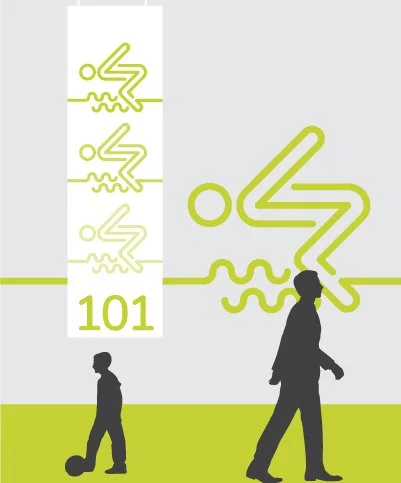

We use powerful graphic communication to tell the story of places. Spanning from public artworks and installations to urban supergraphics, place identity creates stronger recognition and a sense of belonging. What makes us unique among environmental graphics practices is that we have the detailed architectural skill base to work alongside larger design teams to seamlessly integrate our work directly into the fabric of the architecture and landscape, avoiding add-on solutions.


Combining graphic, product and spatial design, we create narrative environments for exhibitions. Each starts with a conceptual framework: a spatial interpretation of its themes that shapes form, material and graphics together. Content and design are resolved as one, from the scale of the room to the detail of the page.
Universal by Design
219+ projects across 5 continents: A global footprint from North America to Europe, Asia, South America, and Australia.
With studios in London, Milan and Guangzhou, we work as lead consultant, specialist subconsultant or embedded partner within larger design teams. Our clients include municipalities, cultural institutions, developers, transport authorities and global brands.
Two of our most significant current commissions sit at either end of Asia. In Riyadh, we are wayfinding consultants on the Expo 2030 masterplan, our third Expo after Astana 2017 and Dubai 2020. In Hong Kong, we are delivering visual identity, wayfinding and signage for the West Kowloon Cultural District.
Our Projects
We work across a wide range of scales and sectors - from World Expos and cultural institutions to airport terminals, mobility hubs, retail masterplans and entire new cities. This breadth isn't incidental: it reflects how we work. Bringing together architects, urbanists, graphic designers and product designers from 19 countries, we approach every project from multiple disciplinary angles, starting from the specific cognitive, cultural and spatial demands of its site.
What stays consistent is our focus on the human experience of space - treating wayfinding not as a layer applied at the end of a project, but as a discipline embedded from the earliest stages of design.
People
Our work starts with people. We help our clients define the strategic positioning of their development through insight into their target audiences' needs, behaviours and motivations, gathered through direct research and spatial behaviour modelling.
Where We Work
What We Design
Vision
Research insight and client ambition resolve into a single Experience Vision and Narrative, grounded in each project's particular opportunities and constraints. It gives every stakeholder on the design team a shared, stable reference point to plan and test against, in place of subjective preference and ad hoc judgement.
Place
Memorable places have defining characteristics rooted in their history, culture and geography. We uncover these through research and translate them into spatial form, use and story. Tied together by a common narrative, they turn a sequence of moments into a coherent sense of place.
Countries of Practice
Spatial Analysis and Methodology
We use a methodology developed at UCL's Space Syntax Laboratory and tested in practice for over 30 years.
It forecasts patterns of movement and use in cities and complex buildings, showing how layout shapes behaviour before a single sign goes up. We use it to map how people move, decide and interact, and to ground every design decision in real behaviour rather than assumptions.
Making complex processes intuitive and natural
We combine strategic thinking with the latest analytical tools and computational models to predict and interpret movement. Large projects often produce complex spatial frameworks, and our research distils them into a single visual narrative and design concept. Like Harry Beck's 1930s London Underground map, our topological maps simplify that complexity into something that feels natural and intuitive.
Bespoke Product Design
Every project begins with a close reading of its context: cultural heritage, local craft and the natural landscape. That research shapes form, material, colour, typography and mapping, so each element is resolved for where it will live rather than imported from a generic system.
The result is a signage and product language specific to its site. It speaks to the architecture, meets the client's brief and reads clearly within the region's cultural and social conditions.
Bespoke signage product-design study illustrating a project-specific product design solution.
Bespoke signage product-design study illustrating a project-specific product design solution.
Graphic Communication
We use graphic communication to tell the story of places, from place identity systems and urban supergraphics to public art and installations.
Our architectural skill base is what sets us apart among environmental graphics practices: it lets us integrate this work directly into the fabric of the architecture and landscape, working alongside larger design teams rather than adding it on afterwards.